
Knik-Goose Bay Road: Vine Road to Settlers Bay Drive
What's New!
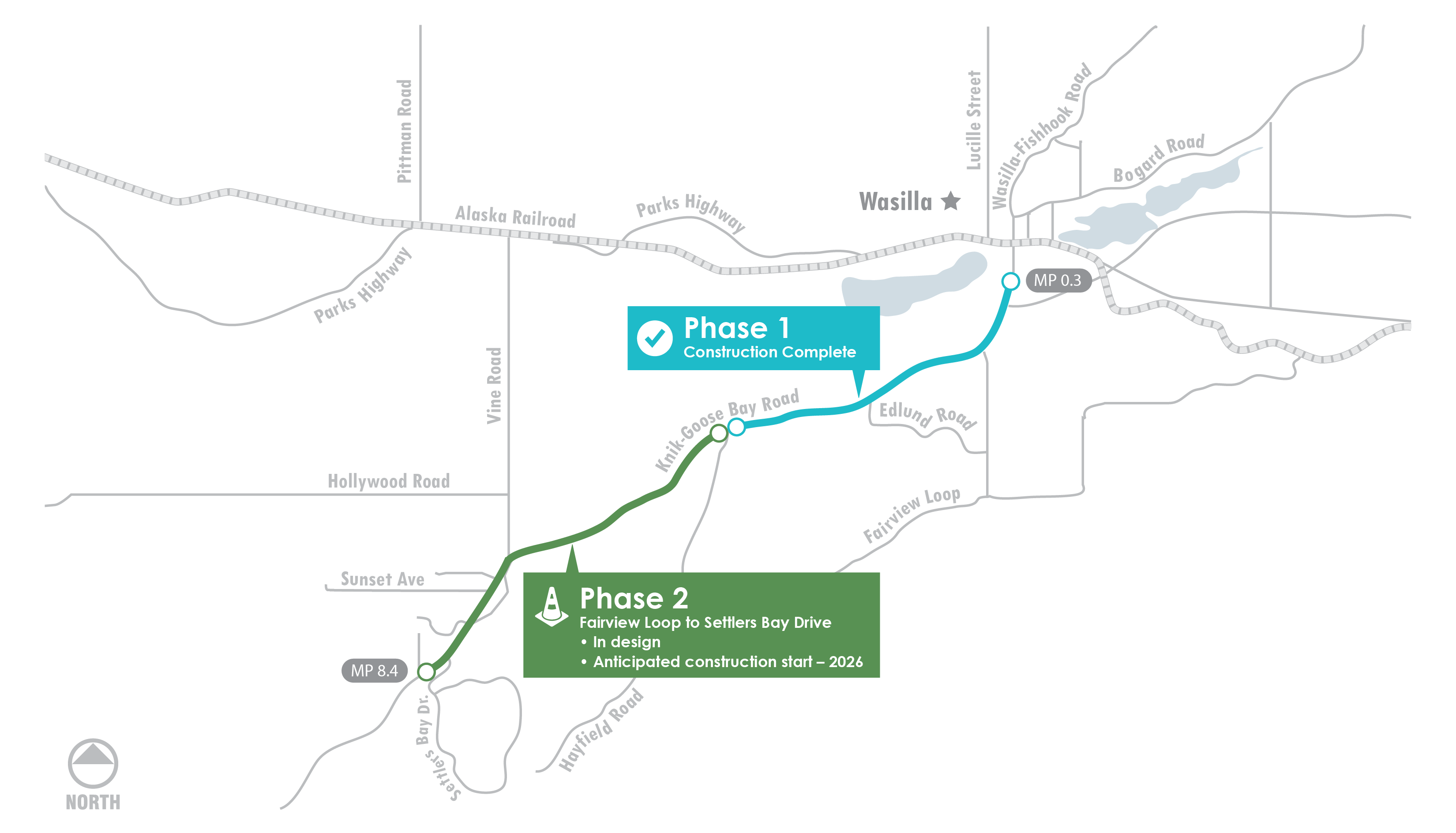
Project Status
- Roadway and hydrology design for the segment from Fairview Loop to Settlers Bay Drive (Phase 2) is approximately 85% complete.
- Utility relocation designs are in development.
- Property appraisals and acquisitions are underway.
What's Next
- Finalizing hydrology, intersection and signal, and roadway design.
- Coordination with utility companies to finalize utility relocation design and begin drafting agreements.
- Continue property appraisals and acquisitions.
Project Overview
DOT&PF has developed two projects to reconstruct Knik-Goose Bay (KGB) Road between Centaur Avenue and Settlers Bay Drive. KGB Road has congestion, poor performance, and high collision rates. This effort will expand the corridor to a four-lane, divided roadway with a separated multi-use pathway on the north side that will allow KGB Road to function more efficiently with fewer delays, more capacity, reduced conflicts, and increased safety.
Project Goals
The two primary goals of this project are to increase capacity and improve safety. The corridor currently experiences congestion, poor performance, and high collision rates, particularly during peak hours, due to limited capacity and a high density of driveway access. Congestion issues are only expected to increase, spurred by development along KGB Road, future land development in the Point MacKenzie area, and anticipated population growth in the Matanuska-Susitna Valley.
This project will address capacity issues by:
- Adding travel lanes;
- Limiting access to maximize the through capacity and minimize conflicts in the corridor; and
- Improving intersection control, such as auxiliary lanes, signal location, and signal progression.
Safety issues will be addressed in this project by considering:
- Medians and widened shoulders;
- Additional and redesigned pedestrian facilities; and
- Access control by reducing the number of driveways and approaches that access KGB.
Typical Section
Click image below for larger view of the Typical Section

Project Purpose and Need
Purpose
- Improve safety
- Reduce congestion
- Enhance access management
- Increase travel efficiency
Need
- Reduce high severity crash rates along the corridor, particularly head-on collisions, and reduce conflicts along the corridor for vehicles and roadway users.
- Reduce congestion for users and reduce delay at signalized and unsignalized intersections.
- Decrease travel time for users along the corridor. Safely and efficiently accommodate mobility for longer trips and accessibility to adjacent land and local streets.
Project Area Background
This section of roadway has a mix of industrial, commercial, and residential uses and is identified by DOT&PF as a principal arterial. Prinicipal arterials are intended to carry high volumes of traffic with limited disruptions that can be caused by frequent access points. They reduce travel time and increase mobility for longer trips while providing increased safety. In 2009, this roadway was designated by DOT&PF as a Traffic Safety Corridor due to a fatal and major injury accident rate that was 3.8 times the national average. There are undeveloped sections of land along this roadway segment, and future land development is anticipated to increase use of the road corridor.
Potential right-of-way (ROW) acquisitions, utility conflicts, and ongoing drainage issues have been identified. The project team developed a NEPA-compliant environmental document, a Design Study Report (DSR), and is developing bid-ready documents (known as Plans, Specifications, and Estimates [PS&E]). See the Schedule and Public Involvement pages for details on the timeline of this project.
![]()
State of Alaska Project No. Z517170000
Project Information
www.knikgoosebay.comRegional Links
Use DOT&PF's Alaska Project Exchange tools to learn more about all of DOT&PF's active construction projects statewide!
Join the Mailing List